
Kuari Pass Trek Altitude: Different Campsites and Summit
The Kuari Pass trek is one of the most popular Himalayan treks in Uttarakhand, renowned for its snow-covered mountains, frozen lakes during winter, and picturesque forests. Typically, the trek lasts five days starting from Pipalkoti village, with a maximum altitude of approximately 12,510 feet (3813 meters).
Overview & Key Altitudes
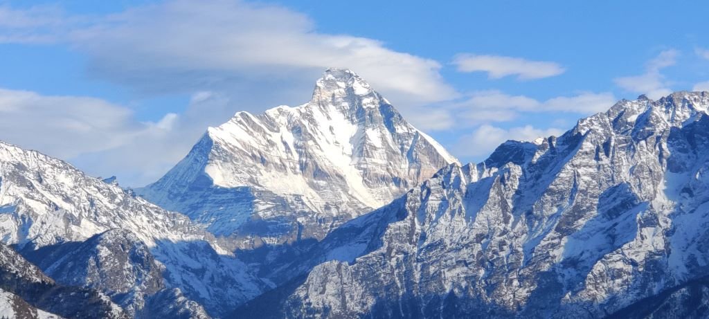
Summit (Kuari Pass Peak): 3,813 m or 12510 ft
Some common camp Altitudes
- Base/start Village : Pipalkoti: 1,260 m or 4131 ft
- Base Start Village : Joshimath: 1875 m or 6150 ft
- Guling Campsite: 2,775 m or 9104 ft
- Khullara Campsite: 3,350 m or 11000 ft
- Tali Campsite: 3300 m or 10826 ft
Now, let us see the day-wise altitude gain during the Kuari Pass Trek
Day | Route | Start Altitude | End Altitude | Approx altitude gain/ loss | Highlights and notes |
Day 1 | Dehradun to Pipalkoti drive | Approx 640m or 2100 ft (Dehradun) | Approx 1260 m or 4131 ft | 620m altitude gain mostly by vehicle; trekking begins next day. | It is quite a long drive (Approx270 km, 8-10 hours). Take Rest, acclimatize. |
Day 2 | Pipalkoti to Guling | Approx 1,260 m or 4131 ft | Approx 2,775m or 9,104 ft | Approx 1515m of altitude gain. Since the altitude gain is more than 1000m. you need to drink water and follow the TL instruction. | This is about 2-3 km walk through pine/maple forest; some steep climbs, stream crossings. Good day for setting pace. |
Day 3 | Guling to Khulara | Approx 2,775 m or 9,104 ft | Approx 3350 m or 11,000 ft | + Approx 575 m altitude gain. | Long day in distance approx 6km opens up into meadows; excellent views of surrounding peaks. |
Day 4 | Base camp to summit, descend to Tali camp | Start Approx 3,350 m or 11,000 ft → Summit at 12,510 ft 3,813 | Approx 3300 m or 10,823 ft at Tali | Net gain of Approx 463 m to summit, then descend to almost same altitude of around 3300 m | The climb is the hardest stretch of the trek. After enjoying the summit, descend downhill to Tali. |
Day 5 | Tali to Pipalkoti | Approx 3300 m or 10823 ft | Approx 1260 m or 4,131 ft through trek | Approx 2040 m descend to Pipalkoti after 4km trek and 52km drive. | Shorter trek, mostly downhill; relaxing as you descend via forests. Once in Pipalkoti, you can relax as this will be your last night of the trek. |
Day 6 | Pipalkoti To Dehradun | Approx 1260 m or 4,131 ft | Approx 640m or 2100 ft (Dehradun) | Easy Drive crossing through Prayags | Arrival at Rishikesh around 5pm Arrival at Dehradun around 7pm |
Tips for the Kuari Pass trek schedule:
- Acclimatization and Pace – Although the trek is Easy – Moderate, walking too quickly can cause altitude sickness. The increase from approximately almost negligible sea level to between 3,400 and 3,800 m over a few days is substantial.
- Snow and Weather – In winter, the trail near the summit is often snow-covered; therefore, early morning starts and appropriate gear like gaiters and Microspikes are crucial. Temperatures can fall sharply.
- Trail Conditions – The Trail conditions include streams, rocky patches, and steep forested climbs, especially on Days 3 and 4. The descent from the summit is lengthy but provides relief to the knees following the steep ascent.
- Distance Vs Time: The horizontal distance of each day isn’t huge (4-6 km typically on trekking days), but altitude gain and terrain make walking slow, especially near the summit day. Plan conservatively.
- Things not to forget : Other than the essentials Toiletries, Lunch Box, personal medications if any, Energy Bars
- Medical Certificate: Medical Certificate is mandatory for this trek. Medical happens in nearby hospital at Pipalkoti or Joshimath.