
Kedarkantha Trek Altitude: Different Campsites and Summit
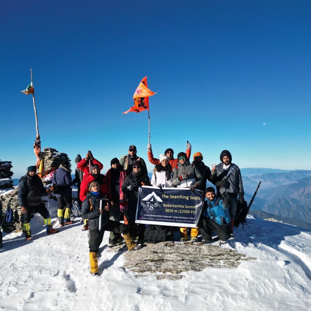
The Kedarkantha trek is one of the most popular Himalayan treks in Uttarakhand, renowned for its snow-covered mountains, frozen lakes during winter, and picturesque forests. Typically, the trek lasts five days starting from Sankri village, with a maximum altitude of approximately 12,500 feet (3810 meters).
Overview & Key Altitudes
- Summit (Kedarkantha Peak): 3,810 m or 12500 ft
Some common camp Altitudes
- Base/start village (Sankri / Kotgaon): 1,950 m or 6400 ft
- Juda Ka Talab (lake campsite): 2,775 m or 9100 ft
- Base Camp / Lohasu / “Kedarkantha Base”: 3,440 m or 11250 ft
- Hargaon / intermediate descent camp: 2710 m or 8900 ft
Now, let us see the day-wise altitude gain during the Kedarkantha Trek
Day | Route | Start Altitude | End Altitude | Approx altitude gain/ loss | Highlights and notes |
Day 1 | Dehradun to Sankri drive | Approx 640m or 2100 ft (Dehradun) | Approx 1950 m or 6,400 ft | 1400m altitude gain mostly by vehicle; trekking begins next day. | It is quite a long drive (Approx200-220 km, 8-10 hours). Take Rest, acclimatize. |
Day 2 | Sankri to Juda ka Talab | Approx 1,950 m or 6400 ft | Approx 2,775m or 9,100 ft | Approx 820-850m of altitude gain. Since the altitude gain is less than 900m you can acclimatize well without any medical help. | This is about 4-5 km walk through pine/maple forest; some steep climbs, stream crossings. Good day for setting pace. |
Day 3 | Juda ka Talab to Kedarkantha base camp (Lohasu) | Approx 2,775 m or 9,100 ft | Approx 3440 m or 11,250 ft | + Approx 650-700 m altitude gain. | Shorter day in distance approx 3km opens up into meadows; excellent views of surrounding peaks. |
Day 4 | Base camp to summit, descend to Haragaon camp | Start Approx 3,440 m or 11,250 ft → Summit at 12,500 ft 3,810 | Approx 2710 m or 8,900 ft at Hargaon | Net gain of Approx 310 m to summit, then descent of Approx 1,100-1,130 m) | Early start (pre-dawn) for summit for sunrise. The climb is the hardest stretch of the trek. After enjoying the summit, descend downhill to Hargaon. |
Day 5 | Hargaon to Sankri and then Return (or stay & return next day) | Approx 2710 m or 8,900 ft | Approx 1950 m or 6,400 ft through trek | Approx 1950 m to 640 m to Dehraun Via Drive | Shorter trek, mostly downhill; relaxing as you descend via forests. Once in Sankri, one can head back to Dehradun by road. |
Tips for the Kedarkantha trek schedule:
- Acclimatization and Pace – Although the trek is moderate, walking too quickly can cause altitude sickness. The increase from approximately 2,800 m to between 3,400 and 3,800 m over a few days is substantial.
- Snow and Weather – In winter, the trail near the summit is often snow-covered; therefore, early morning starts and appropriate gear like gaiters and crampons are crucial. Temperatures can fall sharply.
- Trail Conditions – The Trail conditions include streams, rocky patches, and steep forested climbs, especially on Days 2 and 4. The descent from the summit is lengthy but provides relief to the knees following the steep ascent.
- Distance vs Time: The horizontal distance of each day isn’t huge (4-6 km typically on trekking days), but altitude gain and terrain make walking slow, especially near the summit day. Plan conservatively.